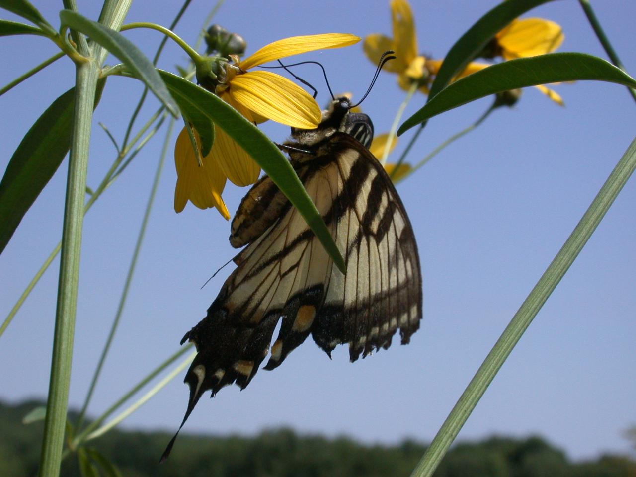
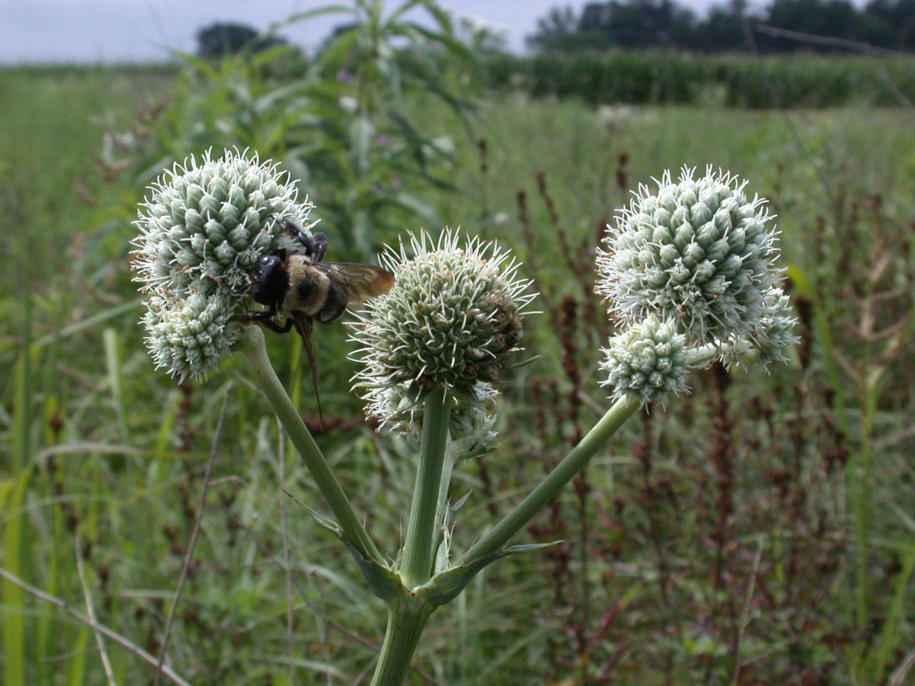
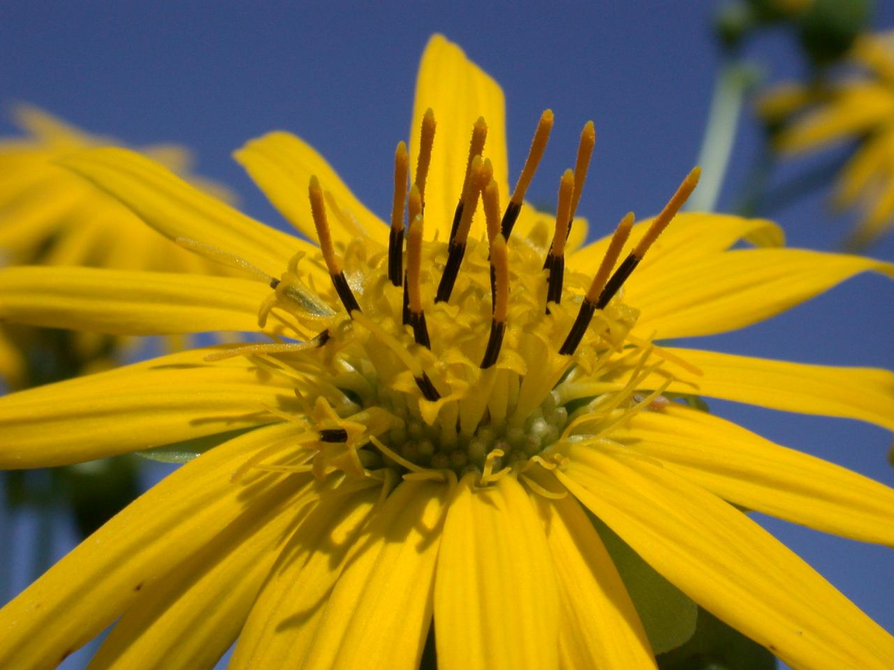
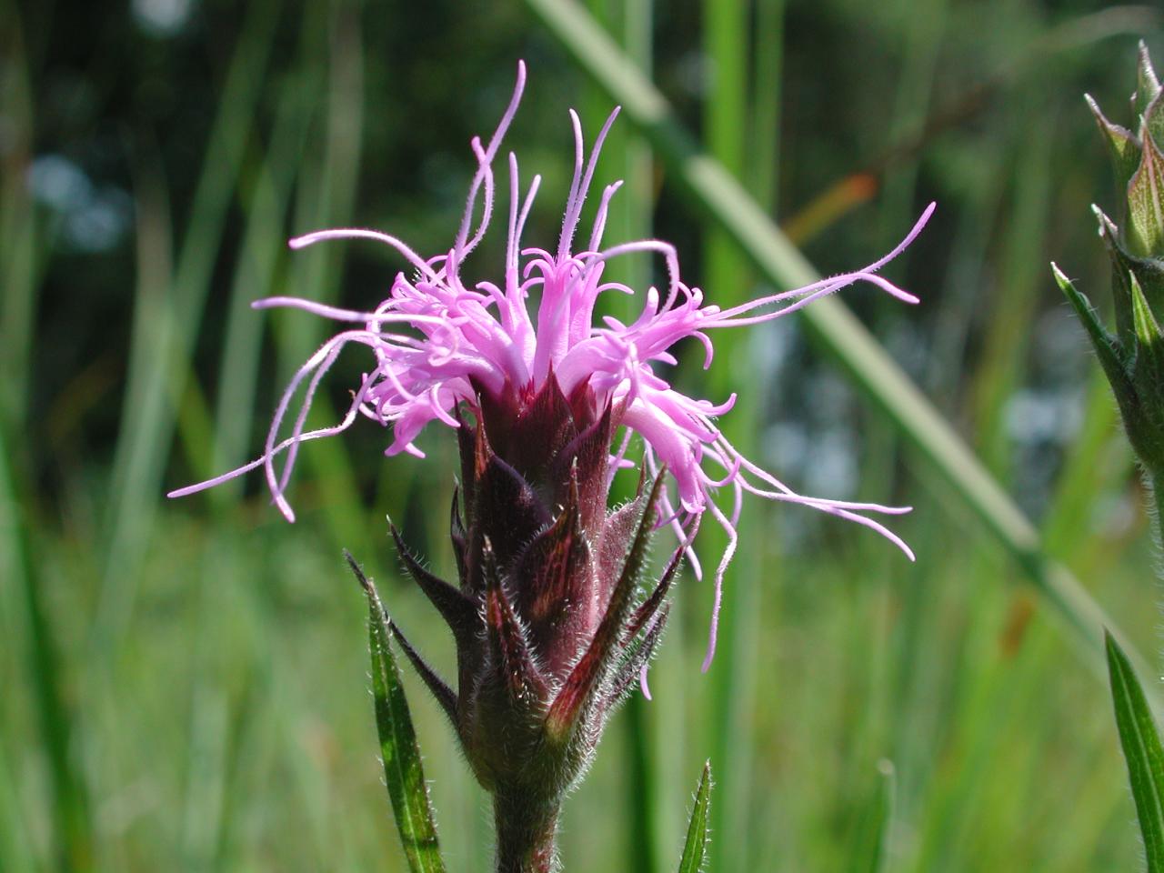
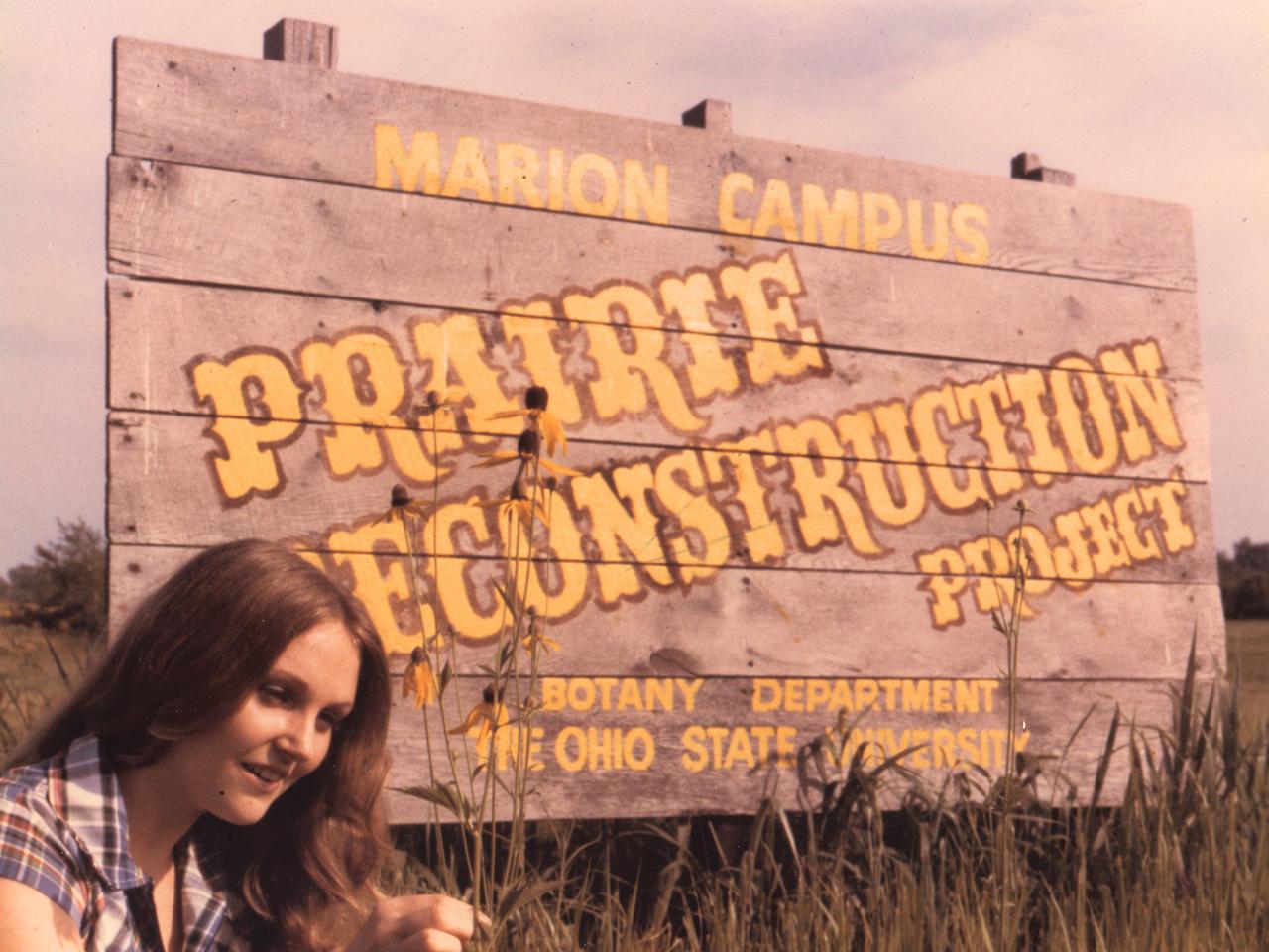
Prairies Around Ohio
Although Ohio typically is not thought of as a "prairie state," portions of Ohio did include extensive areas where trees were sparse. Grasslands occur worldwide, mainly in the dry interiors of continents. In North America, prairies are differentiated into the drier western shortgrass prairie that blends into desert and the moister midwestern tallgrass prairie. There are a number of incredible prairie ecosystems around the state that you should consider visiting!
Kitty Todd Nature Preserve
The 850 acre Kitty Todd Preserve is a centerpiece of the Oak Openings Region and is a model of land management practices for the region. The property is owned and managed by the Nature Conservancy. Kitty Todd Preserve is composed of low-lying wetlands and windblown sand dunes populated by prairie, oak savanna, woodland and forest in a suburban area. Home to the globally endangered black oak savana community, the preserve has one of the highest concentrations of rare species of any nature preserve in the state. Notable species include the lark sparrow, Karner blue butterfly and wind lupine. Kitty Todd is a truly amazing prairie that should not be missed!
Location: Toledo Ohio
Link: Kitty Todd Nature Preserve
Irwin Prairie State Nature Preserve
Irwin Prairie is considered the finest example of a sedge meadow in the state of Ohio. The 226 acre wet prairie is dominated by sedges and rushes including more than 26 state-listed species. The site serves as a habitat for migrating songbirds and waterfowl. The best time to visit Irwin Prairie is during July and August to view the summer wildflowers.
Location: Lucas County about 10 miles west of Toledo
Link: Irwin Prairie State Nature Preserve
Erie Sand Barrens State Nature Preserve
Thirty two acres of beach ridges support dry sand prairie species and wet meadows with rare plants. Agricultural activities have disrupted some of the diversity, but many state-listed species remain. The sandy soil at Erie Sand Barrens is perfect for plants like green milkweed, partidge pea and sand panic grass to thrive. Lower lying wet areas hold sedge meadows with plants more common along the Atlantic and Gulf coasts.
Location: Located in Erie County 9 miles south of Sandusky
Link: Erie Sand Barrens State Nature Preserve
Claridon Railroad Prairie
The Claridon Railroad Prairie is a naturally seeded area, not a reconstruction. The prairie is a mile long strip of land that is 50 feet white. While the prairie can be enjoyed from your car, it's diversity is best appreciated by walking along the roadway. The railroad construction likely damaged the prairie yet it still contains over 100 species. The railroad tracks are still in use so use caution during your visit.
Location: Five miles east of Marion, just north of the junction of State Route 309 and State Route 98 along the south side of the CSX Railroad right-of-way
Link: Claridon Railroad Prairie
Killdeer Prairie
Killdeer Prairie is approximately 3 acres of largely wetland prairie with a natural valley and a borrow pit created while constructing the railroad. The naturally seeded area is a true prairie remnant. It is known for its stand of swamp thistle, cowbane, slender gerardia and pierced leaf boneset. One important wildlife note: Massasauga rattlesnakes are known to inhabit an area just 2 miles northwest and are likely living at this site too. Keep your eyes and ears open for these 3 foot long poisonous rattlers.
Location: West of Wyandot County Road 125, on the south side of the CSX railroad tracks less than a mile and a half from Morral.
Big Darby Plains
In 1976, Metro Parks began a prairie restoration at Battelle-Darby Creek. All of the seeds used for the restored prairies at Battelle-Darby Creek and Prairie Oaks Metro Parks originated from the Darby Plains. To preserve the same genetic makeup of the original Darby Plains, the seeds sown at Battelle Darby were collected by hand from natural prairies. The Darby Plains once covered an area about 385 square miles ranging from Union County to the north, Madison County to the west, Pickaway County to the south, and the watershed boundary to the Scioto River to the east, comprising most of the Big and Little Darby watersheds. Many Darby Plains' prairies were wet and had to be drained before they could be settled. As a result, the Darby Plains was one of the last settled areas in Central Ohio.
Link: Big Darby Plains Prairie
Smith Cemetery State Nature Preserve
The Darby Plains once supported a vast tallgrass prairie with scattered groves of oaks and hickories. The area was described as a sea of prairie grasses and colorful prairie wildflowers. Today, bur oak trees grow sparsely and infrequent patches of prairie plants are all that remain. The best remnants of the Darby Plains survive here at Smith and in nearby Bigelow Cemetery.
Location: 2 miles west of Plain City on SR 161
Link: Smith Cemetery State Nature Preserve
Bigelow Cemetery Prairie State Nature Preserve
In 1978, the Bigelow cemetery was dedicated as an interpretive state nature preserve. The Division of Natural Areas and Preserves is working to preserve the tombstones and protect the prairie species within the cemetery. The site has never been plowed or grazed and still contains many colonies of prairie grasses and wildflowers. For many years, Bigelow Cemetery was the only known location in the state for royal catchfly, the cemetery's rarest plant. Summer-blooming prairie wildflowers are at their peak from late June through August.
Location: Eight miles west of Plain City on State Route 161
Link: Bigelow Cemetery Prairie State Nature Preserve
Milford Center Prairie State Natural Area
The remnant is only 1.5 miles long, but it supports nearly 60 different species of prairie plants. Common species to see here include big bluestem, royal catchfly, smooth rose, prairie dock, stiff goldenrod, and gray-headed coneflower. The best time for viewing prairie wildflowers is in late July through August.
Location: Located in Union County, 2.5 miles south of Milford Center along SR 4